| Antique Prints | Autographs | Rare Books | Connecticut | Law |
| Maps | Miscellaneous | Newspapers & Magazines | Historical Memorabilia | Political |
| World War I Posters | World War II Posters |

|
|
|
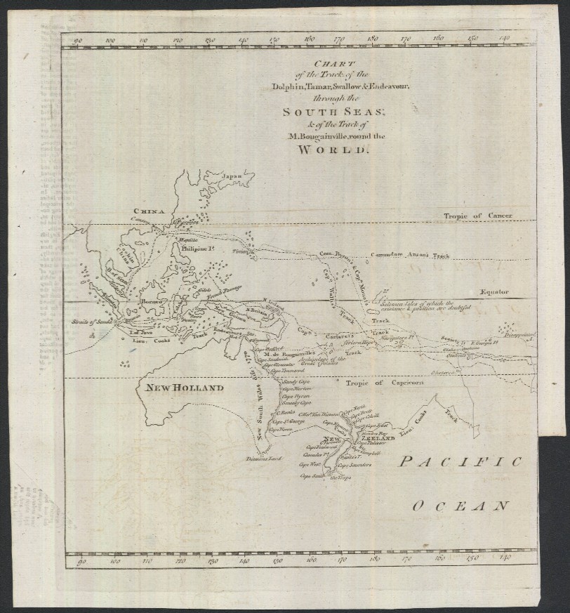
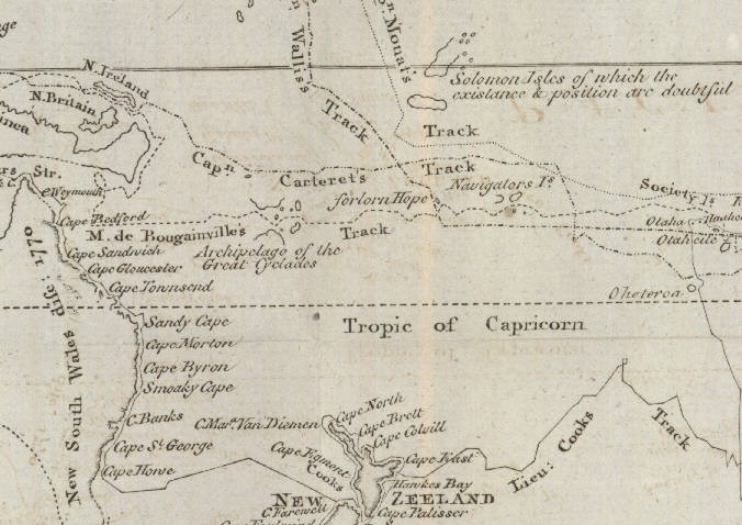
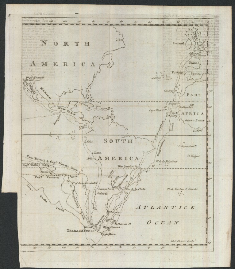
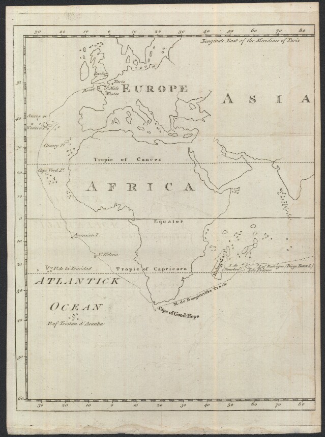
Three Maps Showing Captain Cook's Voyage Around The World "Chart of the Track of the Dolphin, Tamar, Swallow & Endeavor, through the South Seas; & the Track of M. Bougainville, round the World" Below is a close-up of the South Seas or Pacific Ocean map showing some of Cook's most important discoveries and see the reference doubts about the Solomon Islands ("Solomon Isles of which the existence & position are doubtful") and note the absence of any reference to Hawaii which Cook did not "discover" until a later voyage that started in 1776.
The maps vary in size a little, but map image borders are each about 8 x 10 inches and they fit together perfectly so that you can make one world map of Cook's voyage (10 x 24 inches). There is some light text offsetting, but most could probably be removed with a good eraser. It is rare for all three of these maps in good condition to be offered together. Price: SOLD
|