| Antique Prints | Autographs | Rare Books | Connecticut | Law |
| Maps | Miscellaneous | Newspapers & Magazines | Historical Memorabilia | Political |
| World War I Posters | World War II Posters |

|
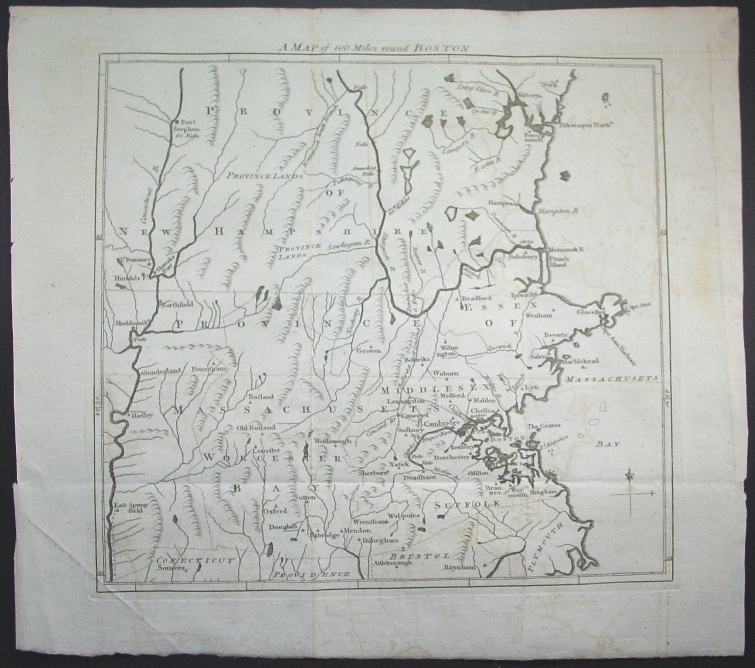
1775 "A Map of 100 Miles round Boston" Area Includes Lexington and Concord Immediately After Those Battles Started the Revolutionary War
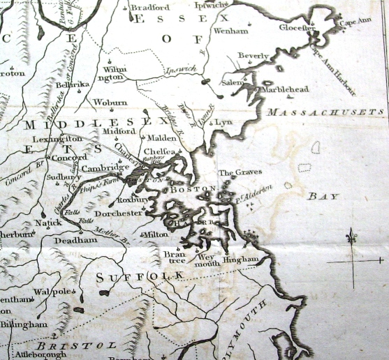
This wonderful map of 100 miles "round Boston" was published shortly after the "shot heard round the world" at Lexington and Concord. 1775 was a momentous year in American history and the events occurring on this map in that year, including the Battle of Bunker Hill, gave the momentum for Revolution and American Independence its final push. Below is a picture of the immediate area around Boston, including the roads to Lexington and Concord on which the famous battles occurred.
The map is in very good condition with light offsetting from being folded, as issued, for over 230 years.
Title: A Map of 100 Miles round Boston
Price: SOLD
|