| Antique Prints | Autographs | Rare Books | Connecticut | Law |
| Maps | Miscellaneous | Newspapers & Magazines | Historical Memorabilia | Political |
| World War I Posters | World War II Posters |

|
|
|
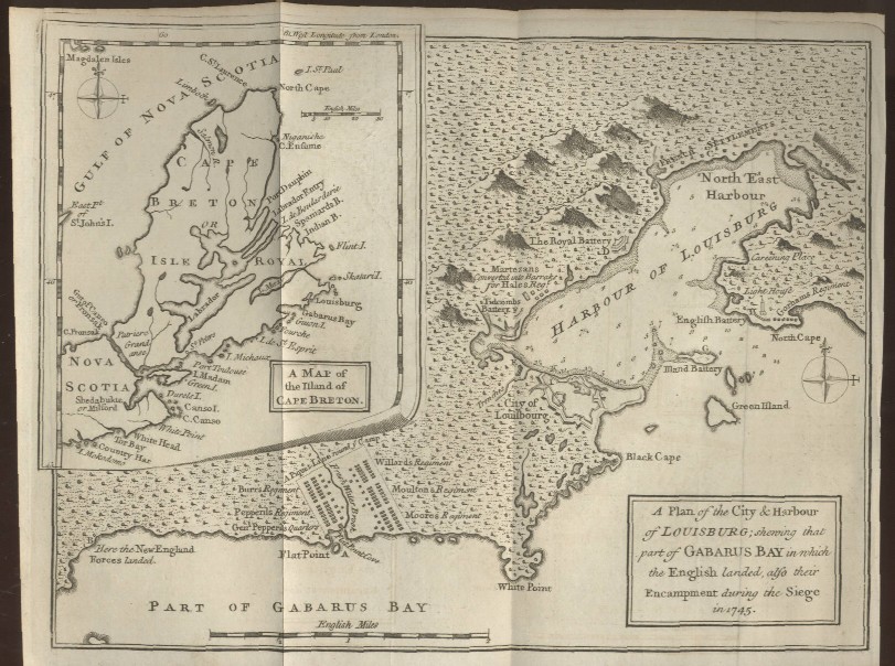
A Plan of the City & Harbour of Louisburg; Shewing that Part of Gabarus Bay in which the English Landed, also their Encampment during the Siege in 1745
This map gives a view of Cape Breton Island and Nova Scotia in the Canadian maritime provinces with a close-up of the City, Harbor and Fortress of Louisburg, an important venue in the French and Indian War. Date: 1758 Price: $100/ SOLD Pay securely with credit card through PayPal by clicking the button below
|