Maps and Views of France
Click on the pictures or titles below to bring
up a higher resolution map with more information, price and a PayPal button to
purchase the map via credit card or bank transfer.
1747
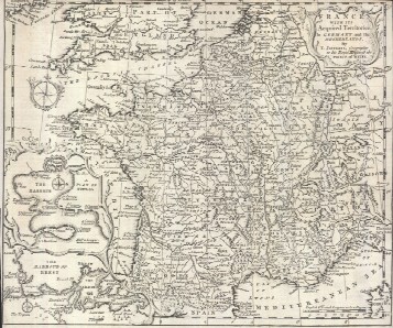
"France with its Acquired Territories in Germany, and the
Netherlands. By T. Jefferys, Geographer to His Royal Highness the Prince
of Wales"
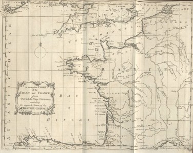
Has inset maps of the Harbors of Toulon and Brest
1746
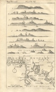
"Bay of Biscay and Lower Brittany by Thomas
Jefferys"
Upper half of plate contains nine views of "The
Cardinals"
1750
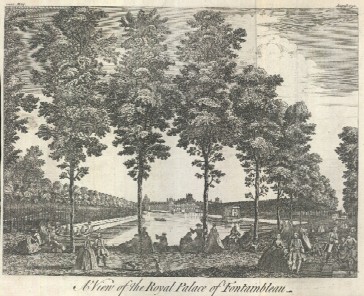
"A View of the Royal
Palace of Fontainebleau"
1757
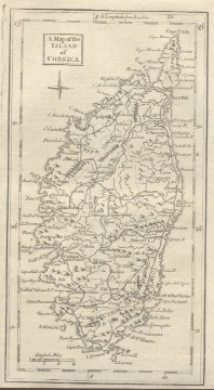
"A Map of the Island of
Corsica"
Birthplace of Napoleon Bonaparte, published in last
year of Corsican independence and two years before the birth of Napoleon
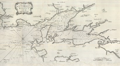
1757
"A Draught of the Road and
Harbour of Brest with the Adjacent Coast"
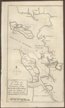
1757
"A Map of the Coast of
France from Rochelle & Rochfort with the Island of Re Oleron & Aix"
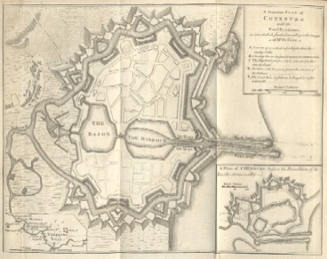
1758
"A Genuine Plan of Cherburg
with the Fortification as intended to be finished according to the
Design of Mr de Caux."
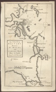
1758
"The Coast of Britany
between St. Malo's and Cancale Bay, Where the English Army Landed June
1758."
1758
"A Complete Chart of the
Coast of France. From Ostend, to Cape Finisterra, Including the Opposite
Coast, of the British Channel."
1758
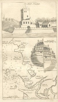
Fort Fouras and Coastal
Vicinity
Decorated with two stern views of a ship showing how
it is vulnerable to shore guns at two water levels.
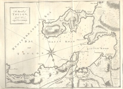
1759
"The Roads, of Toulon, with the
Adjacent Country"
View of port fortifications that young artillery
captain Napoleon Bonaparte (born in year this map issued) made famous 34
years later in 1793.
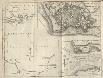
1759
"Plan of Havre de Grace"
and "The Bombardment of Havre de Grace July 4th 1759" and English
Channel
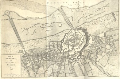
1763
"Plan of Dunkirk, with the
Canal of Mardick, as they were in 1757 "
Pay securely with credit card through PayPal by clicking the
button below