| Antique Prints | Autographs | Rare Books | Connecticut | Law |
| Maps | Miscellaneous | Newspapers & Magazines | Historical Memorabilia | Political |
| World War I Posters | World War II Posters |

|
|
Beautiful Condition 1763 Annual Register 1st Edition French and Indian /7 Years War End, Kings Proclamation Limiting American Expansion Four (4) Early Maps of North America, France, Prussia and India
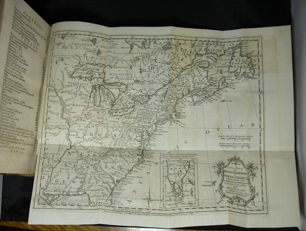
This historic first edition of the 1763 Annual Register is in beautiful condition. This book records the history of 1763 which witnessed the end of the first truly world war, the Seven Years War, which in North America was called the French and Indian War. As Wikipedia notes, the Seven Years War "[I]nvolved most of the great powers of the time and affected Europe, North America, Central America, the West African coast, India, and the Philippines." It is because of the great interest in this war and its aftermath that the 1763 Annual Register is full of news of the war and provides the four fold out maps of the major theatres of the war, North America, India, France and Prussia. Below is a picture of the fine map of North America:
King George III, later famous during the American Revolution, issued an end of war Proclamation ordering his new possessions in North America, most notably Canada, Florida and some Caribbean islands (e.g. Grenada). The Proclamation was important to American history because it partitioned America so that settlements were limited to East of the Appalachian Mountains and required existing settlements to be disbanded and the land returned to the Indians. This caused great dissatisfaction among the settlers and some powerful land owners like George Washington who had property interests West of the Appalachian Mountains. Below are pictures of part of the Proclamation, all of which is included in this volume and which was avidly read by Americans.
The volume is in very nice condition, as shown by the spine picture above and the title page, cover and map pictures below.
As noted above, there are four (4) fold our maps attached to the back of this volume, including the map of North America, with an inset of the Southern part of Florida.
Price: SOLD |